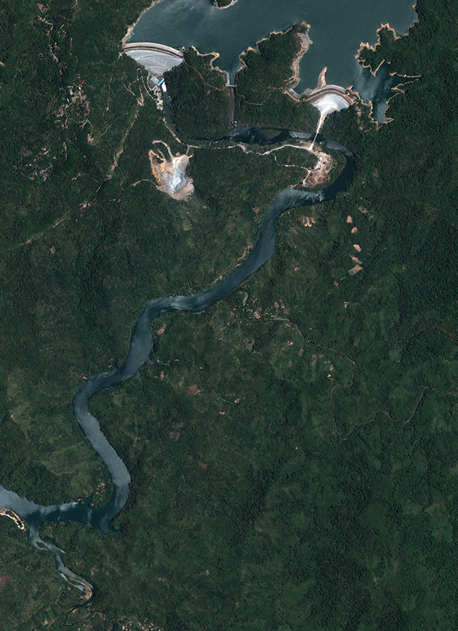
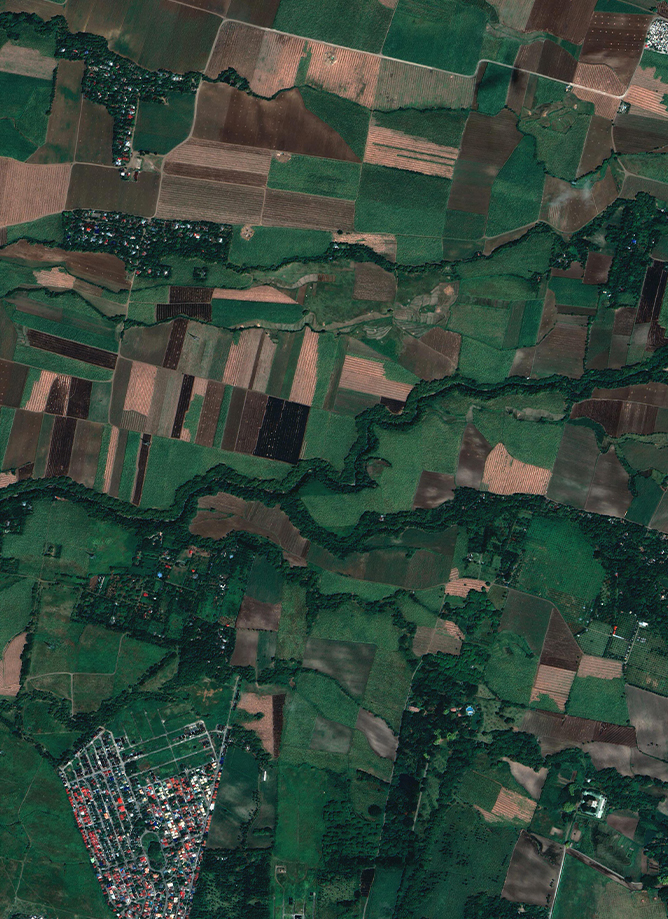
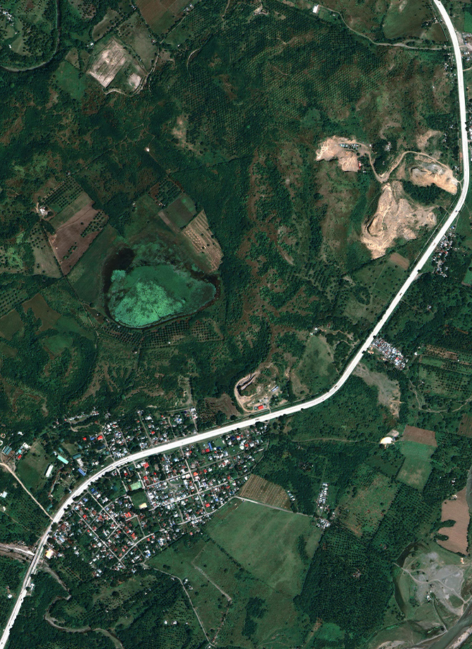
Ipo Watershed
Technical Services for Ipo Watershed
Certeza, committed to bringing the premium solutions to its client, works with industry leaders such as Airbus, Hexagon Safety, Infrastructure Geospatial, Intermap, and Leica Geosystems. We acquire and provide high-resolution and high-accuracy geospatial data from land-based, airborne and spaceborne sensors for various applications. We deliver unprecedented engineering and geospatial software solutions as well as internationally recognized land-based and airborne instruments enabling customers to visualize complex data and make sense of the dynamically changing world. We are committed to provide our clients with outmost care and support, and be their partners in finding the optimal solutions to their geo-information needs and concerns.


CIC provides a full range of quality aerial photography solutions, to ensure highly detailed aerial mapping.
Remote sensing and geographic information system (GIS) are among the many useful means of gathering and analysing information from aerial photography, scanner or radar, and satellite images.
IFSAR is a powerful approach in generating high-resolution digital data through the use of Digital Elevation Model (DEM) and an orthorectified radar image.
LiDAR is an accurate and effective method for ceating three-dimentional topographical aerial maps and highly accurate surveys of both surface terrain elements and manmade structures.
CIC offers a full range of surveying and land development services using a combination of well-established practices and modern technologies.
Remote sensing and geographic information system (GIS) are among the many useful means of gathering and analayzing information from aerial photography , scanner or radar, abd satellite images.
Our Optical and Radar Satellite analytics supports decision makers and analysts across multiple industries, who require a precise and remote view of our changing planet.
OneAtlas Data allows users to access satellite imagery, global datasets, elevation data and 3D models.
Intermap’s 3D foundation data layers provide the framework necessary for governments and businesses to make informed decisions and find intelligent solutions to their planning challenges.
Hexagon's Safety, Infrastructure & Geospatial division provides you with tools to visualize, analyze and derive insight from location information to solve mission and business-critical problems.
Leica Geosystems, DJI Enterprises, Seafloor, RST & IDS is our leading developers, manufacturers and distributors of products, systems, and software that capture, visualize and process 3D spatial data through the employment of advanced technologies.
VIEW PRODUCTSSpecializes in remote detection and monitoring of displacement, subsidence, and geohazards across large areas using Interferometric Synthetic Aperture Radar (InSAR) technology.
VIEW PRODUCTSRST Instruments' grout monitors provide real-time display of key grouting parameters to enhance the understanding of site conditions.
VIEW PRODUCTS
Technical Services for Ipo Watershed
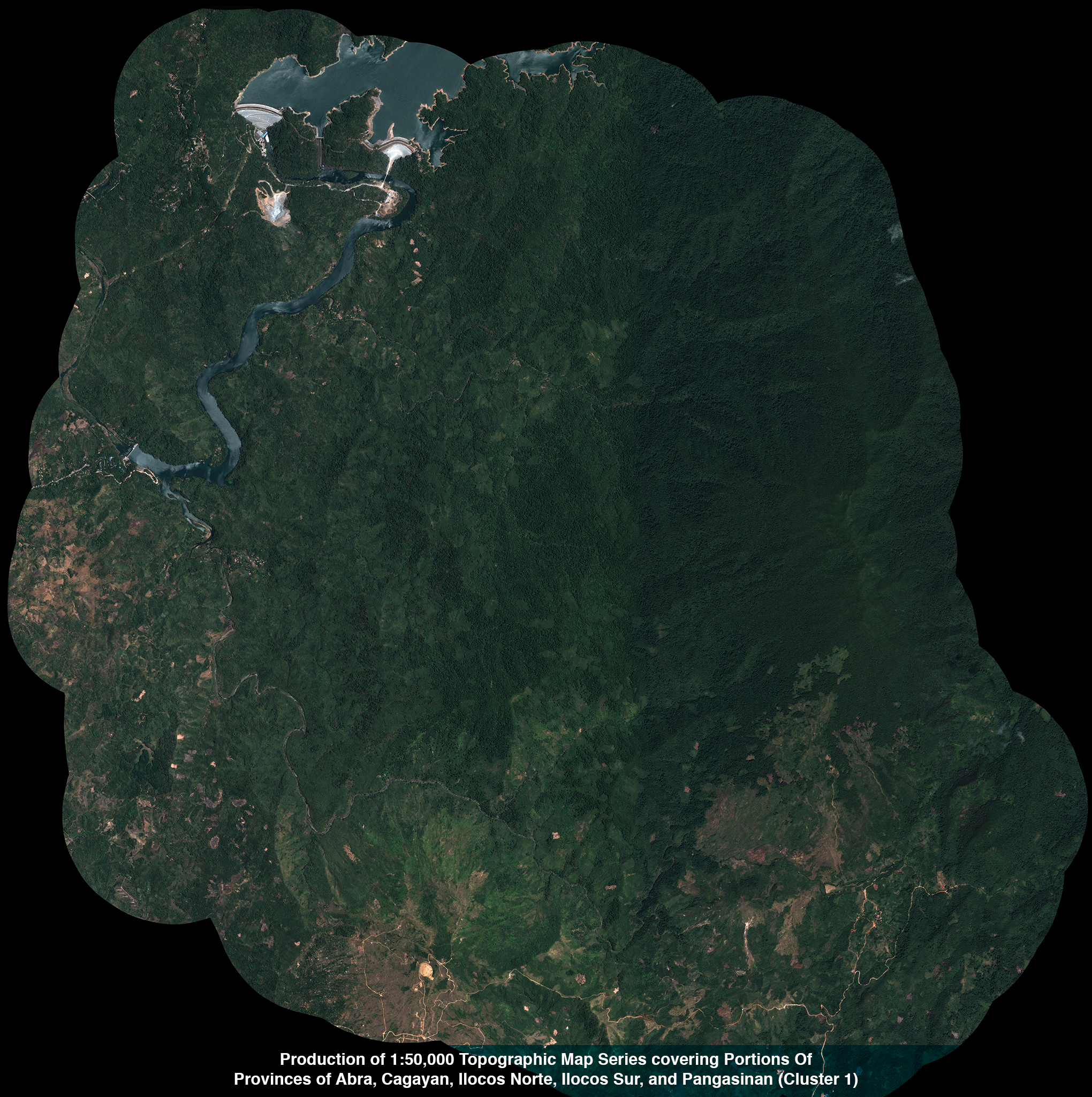
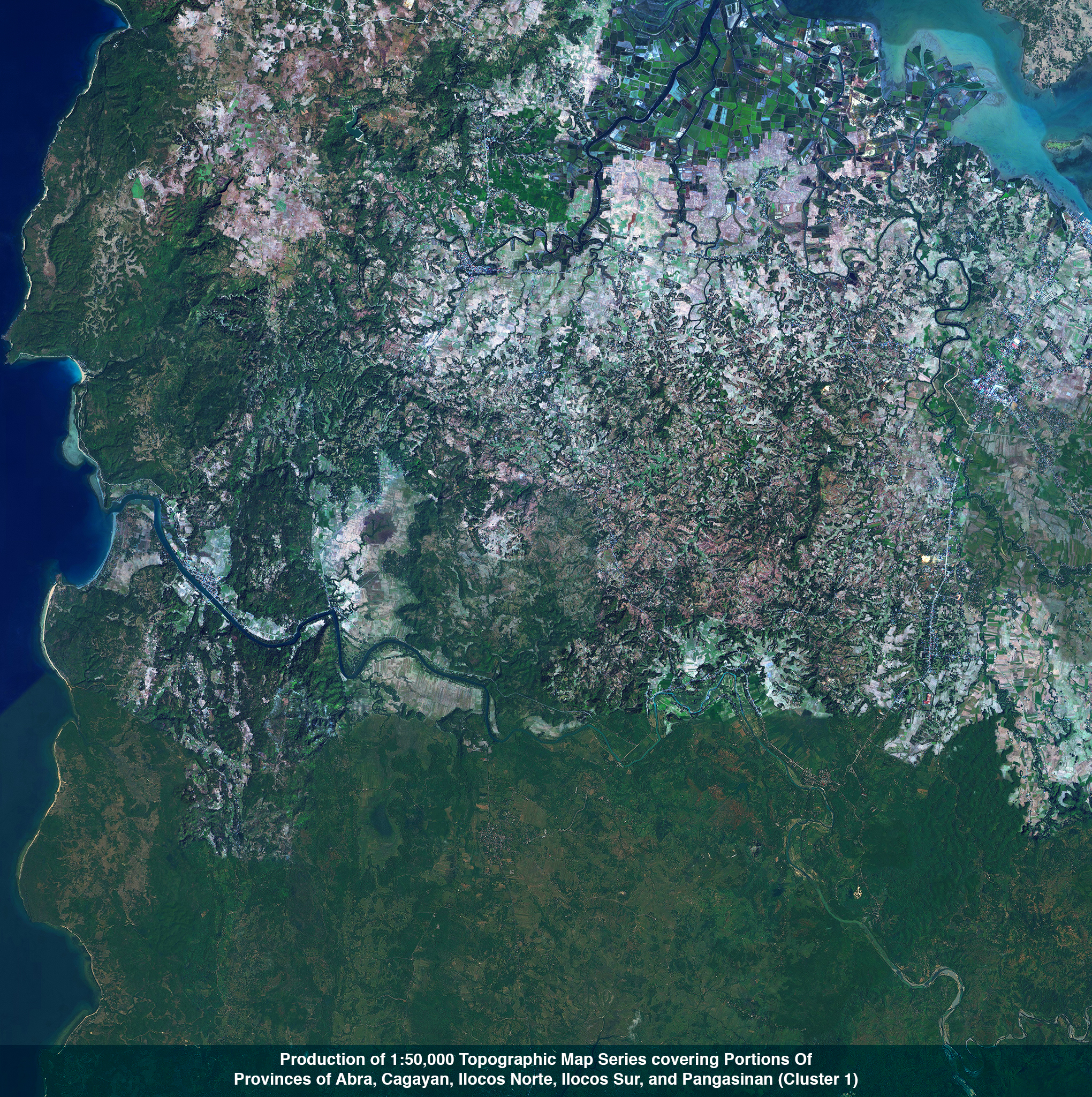
Production of 1:50,000 Topographic Map Series covering Portions Of Provinces of Abra, Cagayan, Ilocos Norte, Ilocos Sur, and Pangasinan (Cluster 1)
Outsourcing for the Production of Updated Large-Scale Topographic Maps at Scale 1:10,000 for the Unified Mapping Project (UMP) CY 2020 Covering the Province of NEGROS ORIENTAL (CLUSTER 38B)
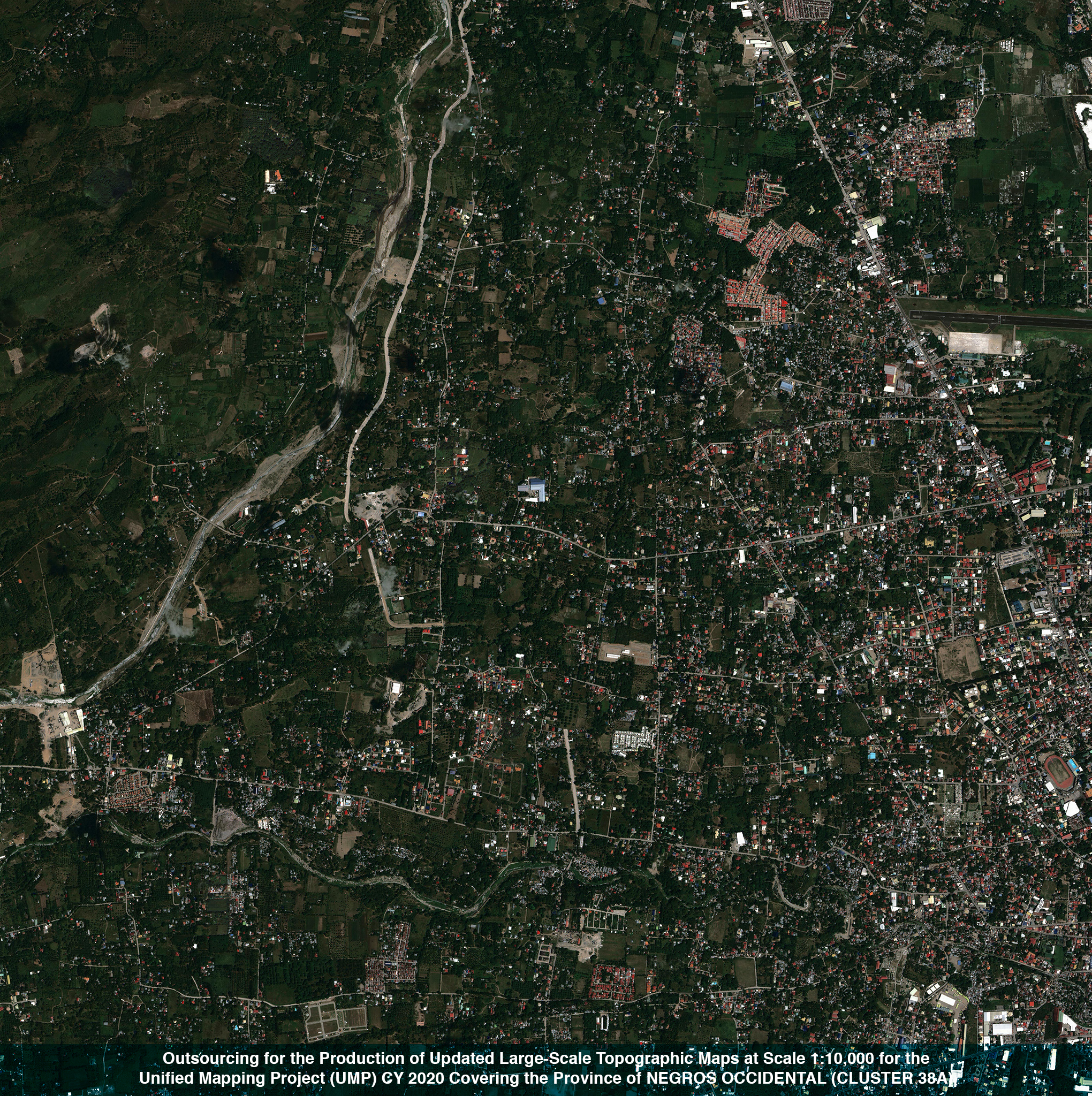
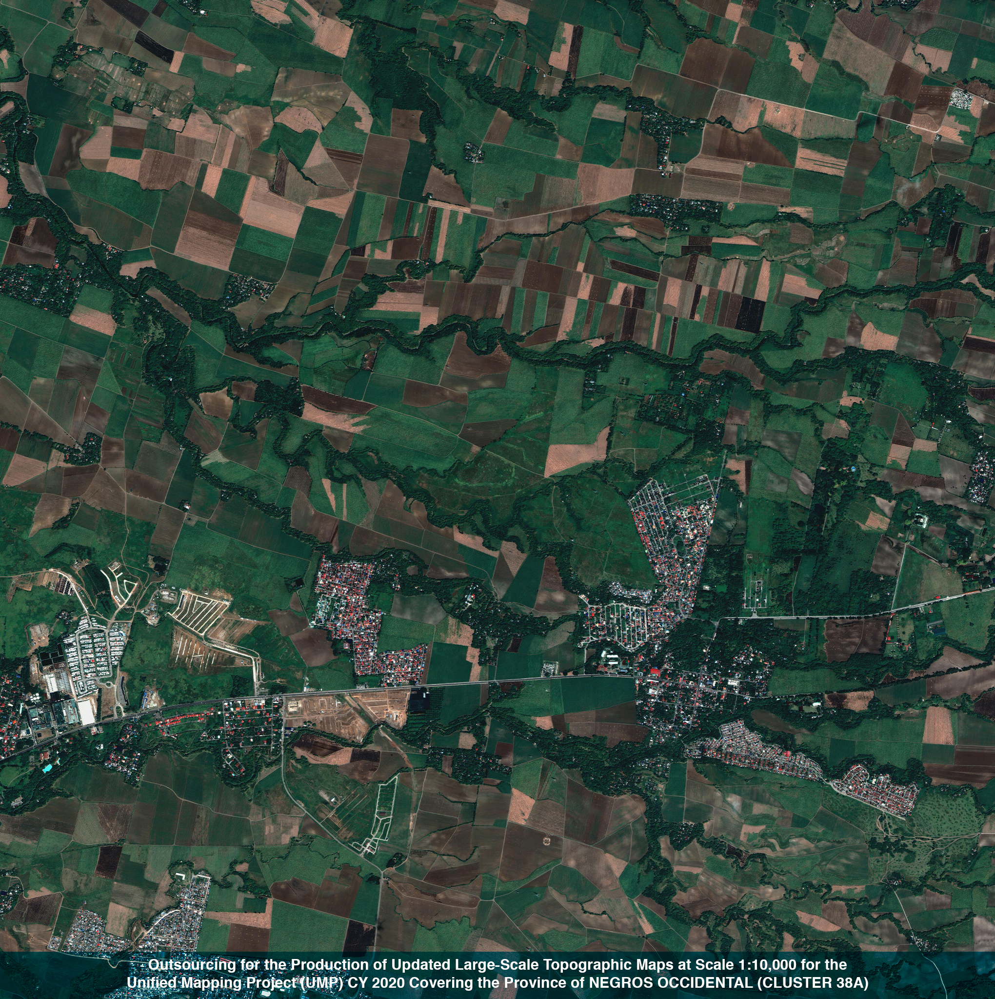
Outsourcing for the Production of Updated Large-Scale Topographic Maps at Scale 1:10,000 for the Unified Mapping Project (UMP) CY 2020 Covering the Province of NEGROS OCCIDENTAL (CLUSTER 38A)
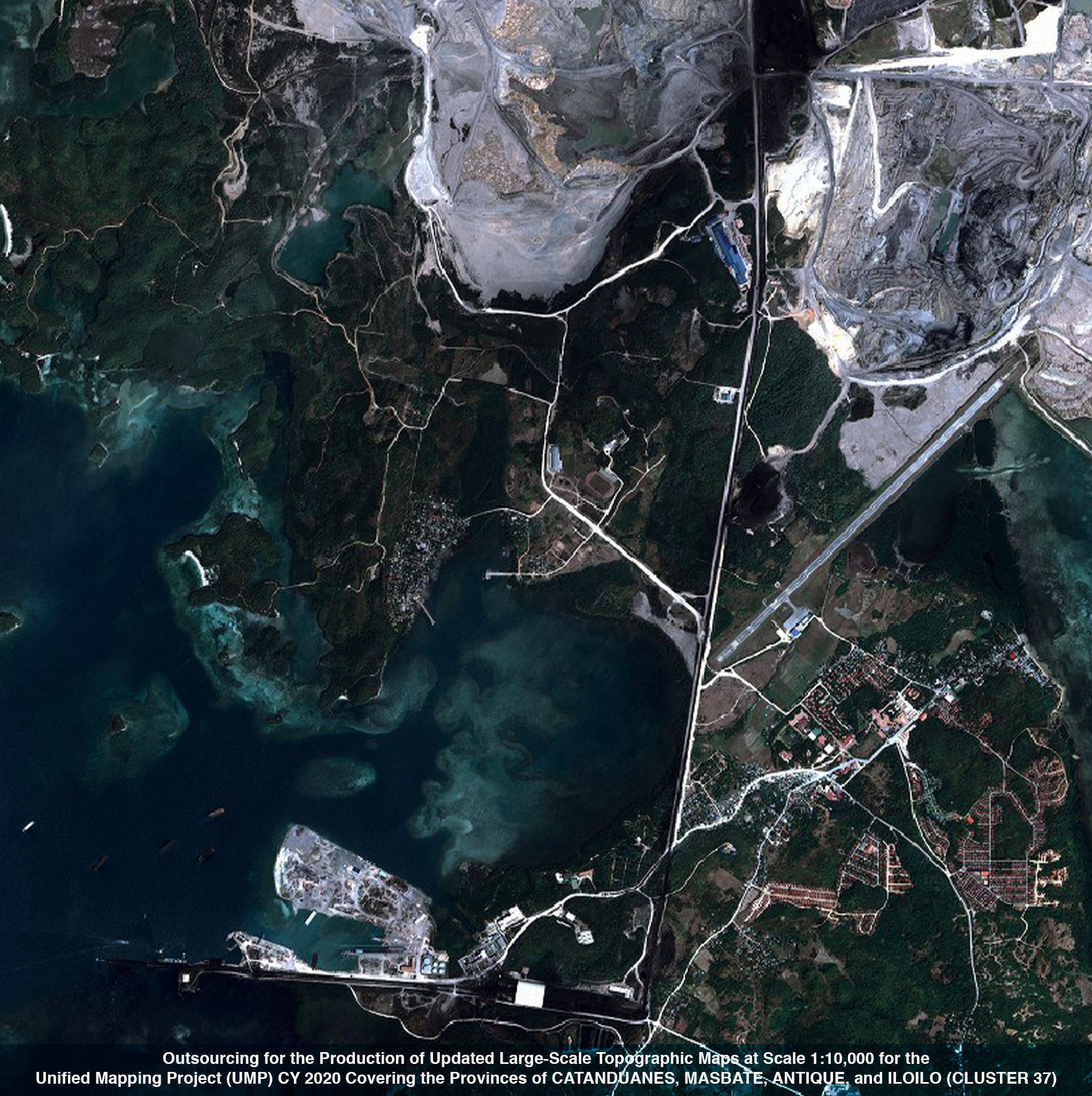
Outsourcing for the Production of Updated Large-Scale Topographic Maps at Scale 1:10,000 for the Unified Mapping Project (UMP) CY 2020 Covering the Provinces of CATANDUANES, MASBATE, ANTIQUE, and ILOILO (CLUSTER 37)
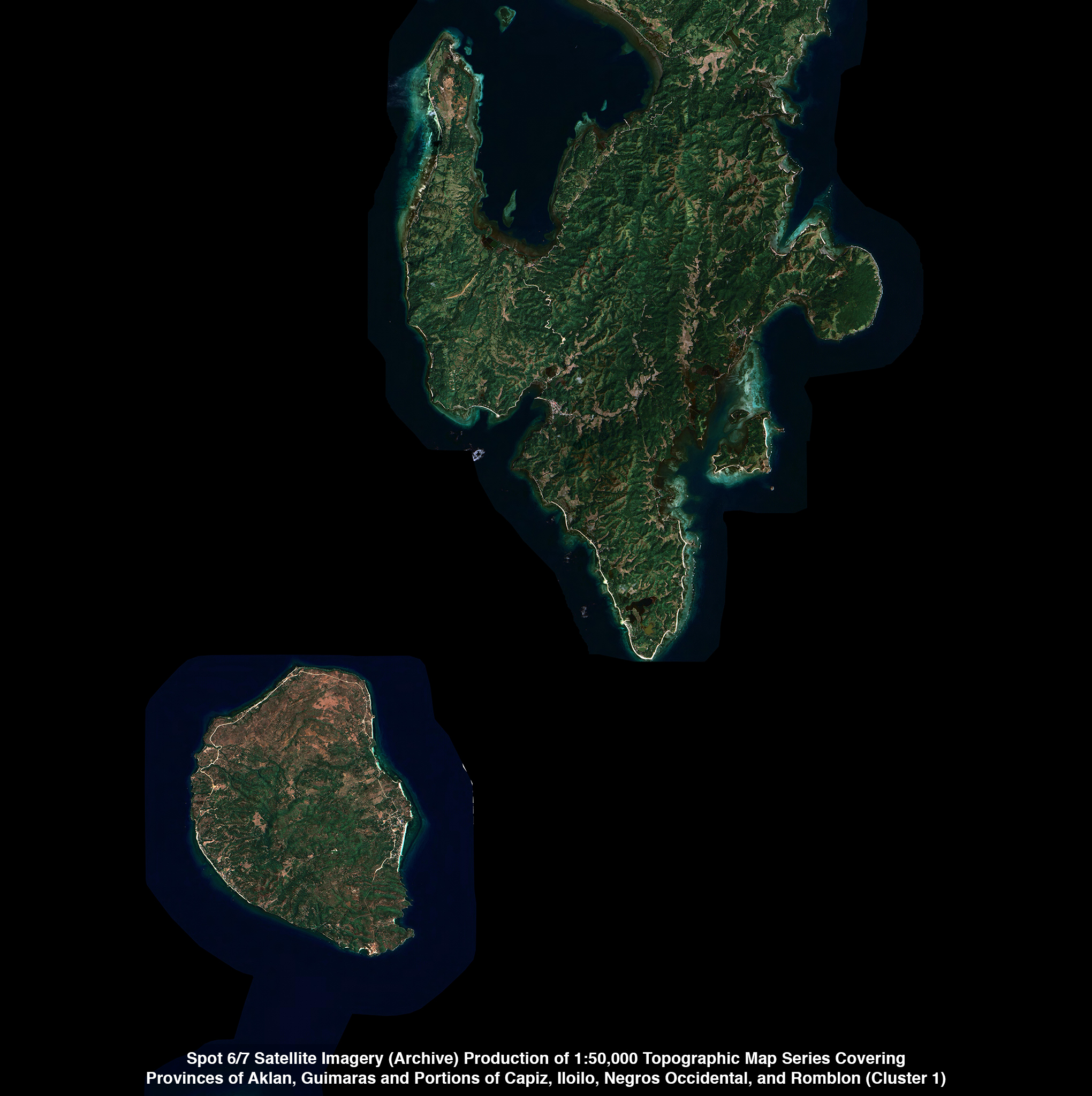
Spot 6/7 Satellite Imagery (Archive) Production of 1:50,000 Topographic Map Series Covering Provinces of Aklan, Guimaras and Portions of Capiz, Iloilo, Negros Occidental, and Romblon (Cluster 1)
Production of 1:50,000 Topographic Map Series Covering Provinces of Capiz, Masbate, and Portions of Aklan, IloIlo and Negros Occidental (Cluster 2)
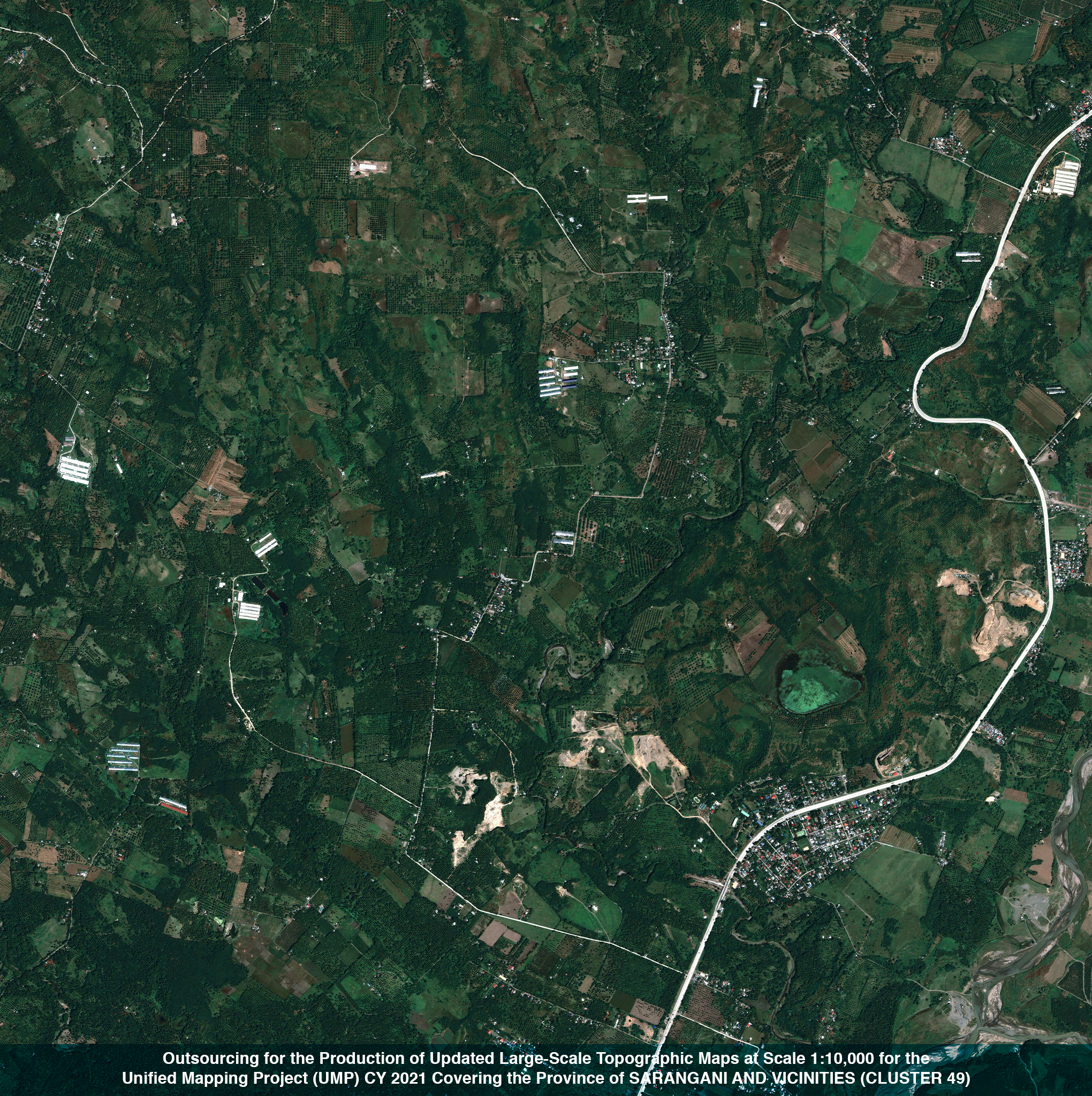
Outsourcing for the Production of Updated Large-Scale Topographic Maps at Scale 1:10,000 for the Unified Mapping Project (UMP) CY 2021 Covering the Province of SARANGANI AND VICINITIES (CLUSTER 49)
Contact us today to learn more about our products and services.
We would be more than glad to assist you with your Geospatial needs. Contact Us


.png)
.png)