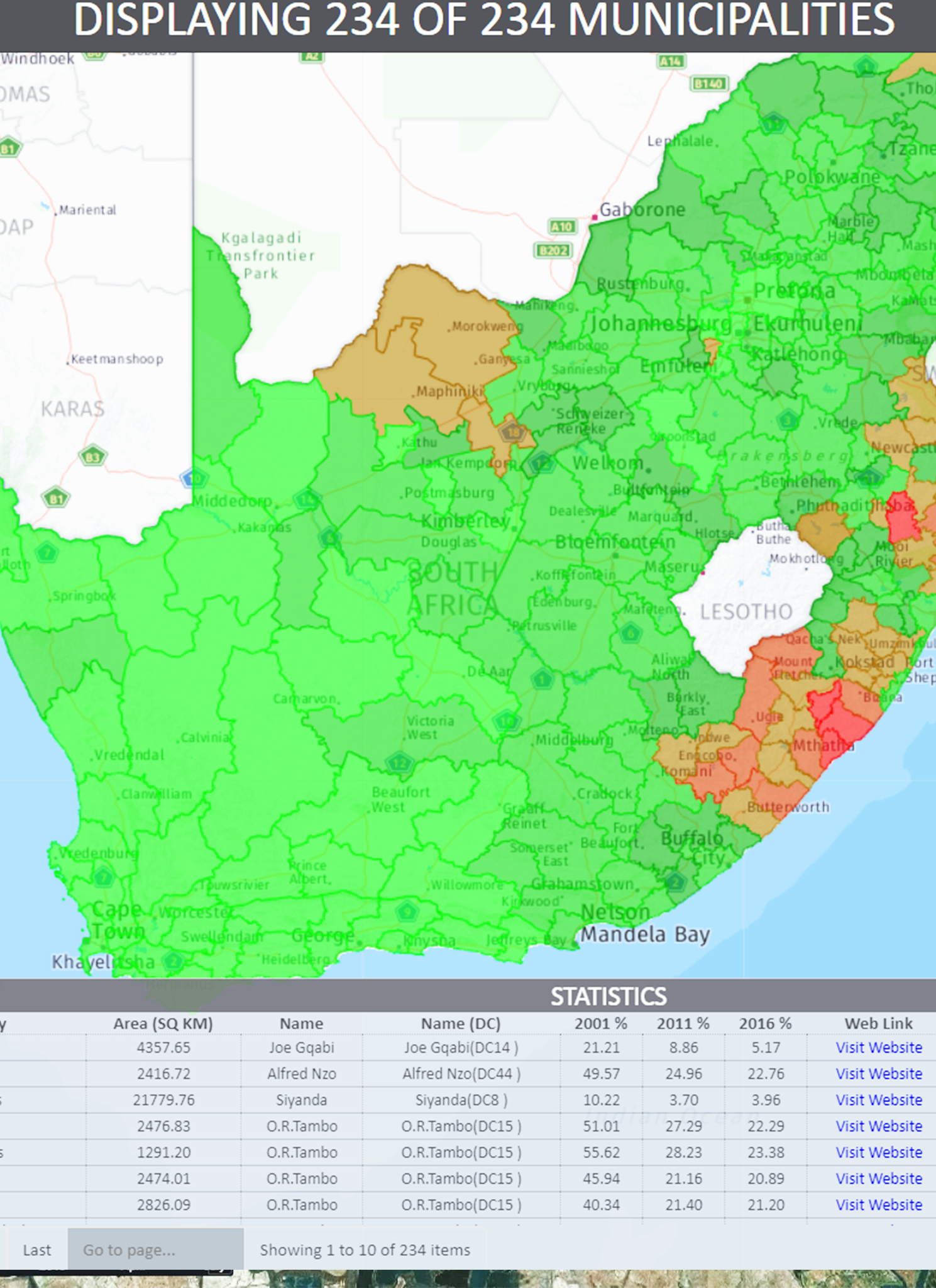
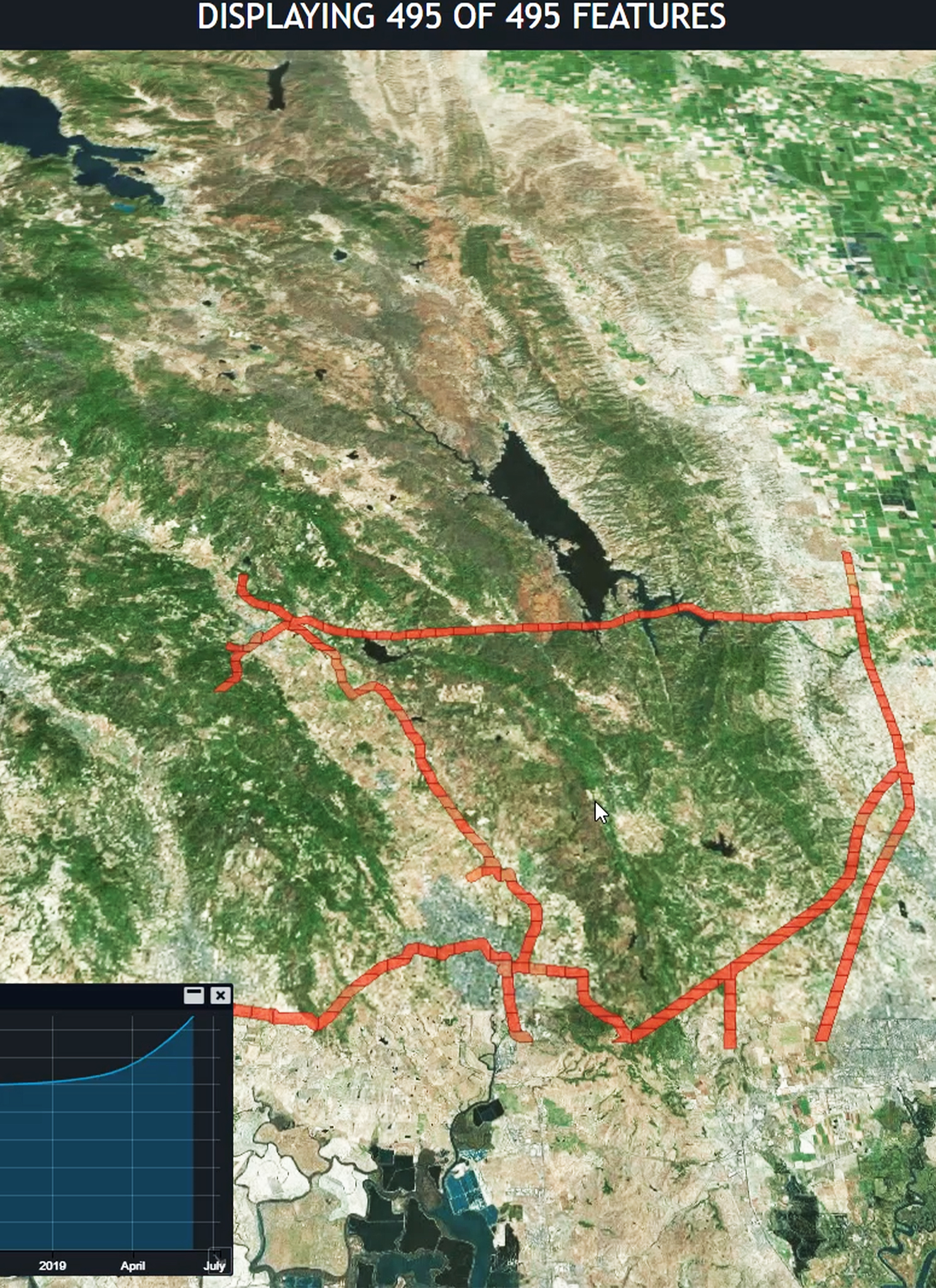
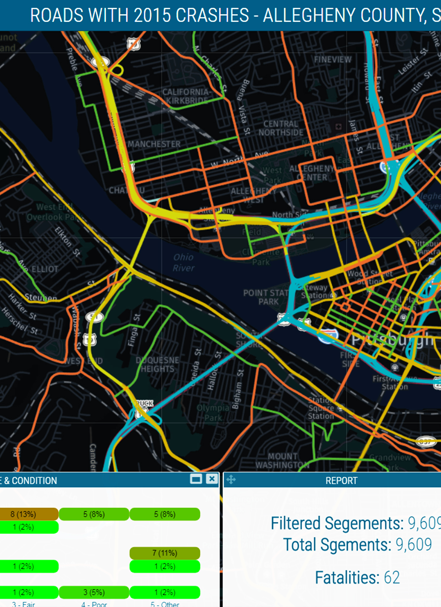
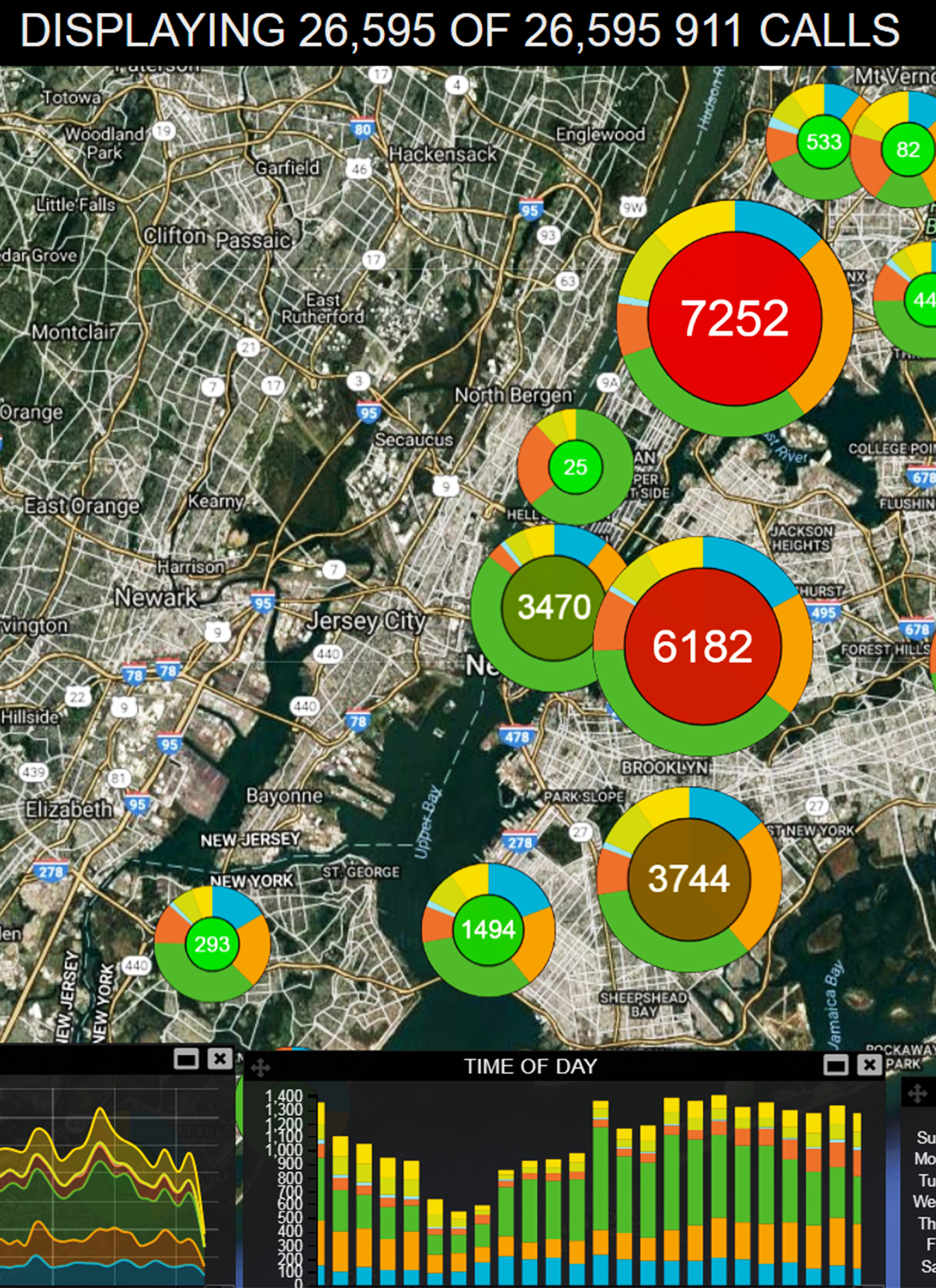
Remote sensing and geographic information system (GIS) are among the many useful means for gathering and analyzing information from aerial photography, scanner or radar, and satellite images. These methods allow mapping and monitoring of the earth's resources. CERTEZA's remote sensing team utilizes real-time imagery in extracting the information necessary for companies' decision making.
Quite apart from disturbing various high-resolution imagery, CERTEZA offers technical assistance on image processing (correction, mosaiking, geo-referencing, orthorectification, feature extraction, ground-truthing, and other value-added services).
CERTEZA also provides consultancy services on the application and use of satellite remote sensing. These services are complemented with the provision of training on the basic concepts of remote sensing technology and hands-on training on the use of iamge processing software.
APPLICATIONS:
Agriculture
Cartography
Change Detection Mapping
Contour Mapping
Forestry Mapping
Land Use / Land Cover
Smart Cities
Smart Monitoring
Topographic Mapping and feature extraction
Watershed Analysis
Check Geomedia our flexible and dynamic GIS Management solution and M.App Enterprise for creating geospatial app for your organization.
Our Partners


.png)